


Many might say that Aran Fawddwy is not really in the ‘Aberystwyth hinterland’ , but my reasons for including it here are 1) that it is really not far away: taking only about 50-60 minutes to the starting point from the Aberystwyth area, 2) that the best and least-used route is from the southwest/Aberystwyth side, and 3) Cwm Cywarch is just about my favourite valley in Wales, bar none. In addition, Aran Fawddwy is a really wonderful uncrowded alternative to Cadair Idris, and is even thirteen metres higher than its much more famous neighbour! I read somewhere that early Victorian visitors were so impressed by Cadair Idris that they thought it must be the highest hill in Britain…it turns out not to be even the highest in the old county of Merioneth…Aran Fawddwy having that honour. Despite it possessing one of the greatest escarpment faces in Wales on its eastern side, there are few really good dramatic views of the mountain from nearby, which may account for its relative lack of impact; however, this circular walk is truly a magnificent day out. This is a serious mountain walk, not to be taken lightly, and only for those with some experience. Wayfinding in cloud and bad weather can be especially difficult on this one, so it is best to choose a reasonably clear day, not least for the amazing all-round views from the summit. Although there is a notorious longish stretch of wet and boggy ground to negotiate which used to have a boardwalk across it, much of which rotted away, the National Park authority have constructing lengths of dry paths across the worst bits, having airlifted in a huge number of bags of shale scalpings. Even so, wear waterproof boots!
(opens in new tab):
of starting point :
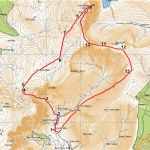
The starting point is the National Park car park in Cwm Cywarch on the left of the lane just before you get to Blaencywarch farm at the head of the valley. The car park is free, with a collection box for donations to the Air Ambulance. Get there by driving from Machynlleth via Mallwyd to Dinas Mawddwy. Bear right down into the village itself, bend round right after the main street, and keep going to Abercywarch where you turn left onto the valley lane (single track).
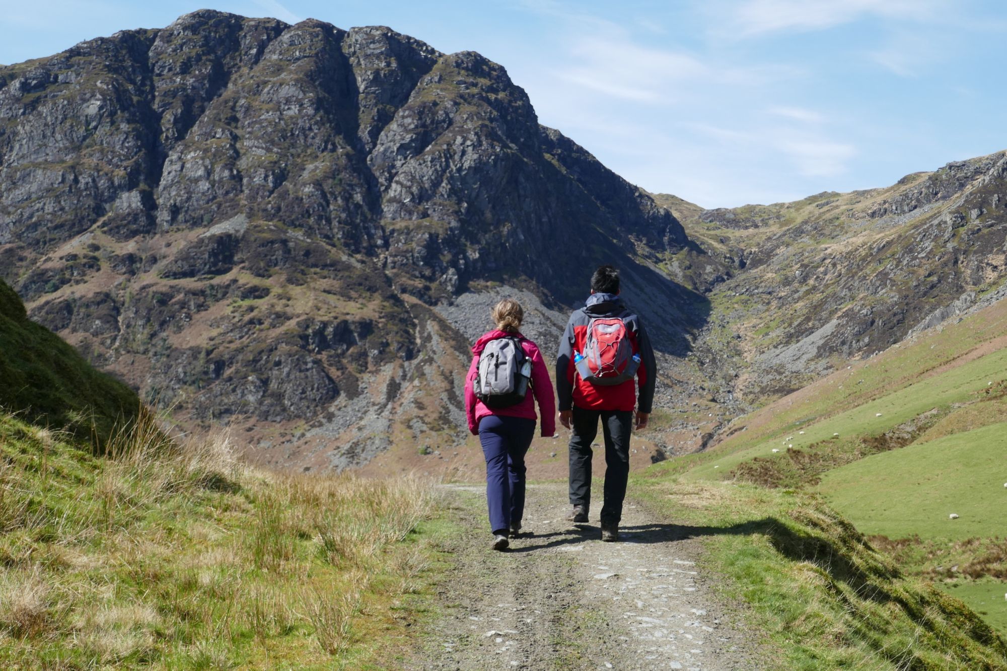
From the car park, walk up the lane past Blaencywarch farm; a short distance further on, a signpost indicates the start of the path to the left.


The path ascends alongside the dry stone wall for a short distance under the glowering cliffs of Craig Cywarch, then turns right and winds up through the bracken on these lower slopes. The path is quite small but easy to follow, with a fairly easy gradient in this first section as it gains height and a lovely view back into the Cwm behind.


The path gets steeper and rockier as it enters the stream gully cutting into the mountainside, bearing round to the left. There is a strong footbridge here which you drop down to, and ascend on the right hand side of the stream for a while. Keep on the clearer defined path where there is the odd choice of routes…the only really ambiguous one is a point where there seems to be a fork, with your correct route off to the left, the other one climbing up the side of the hill to the right.


Eventually, after some effort ascending sharply up the steep rocky gully, the gradient eases and things open out…there is a branching path going over to the right, heading towards a wire fence almost on the skyline and through the first of many boggy areas. Don’t worry if you miss this… over a rise you may see a tiny tarn ahead…take a right turn towards the fence-line at this point instead.

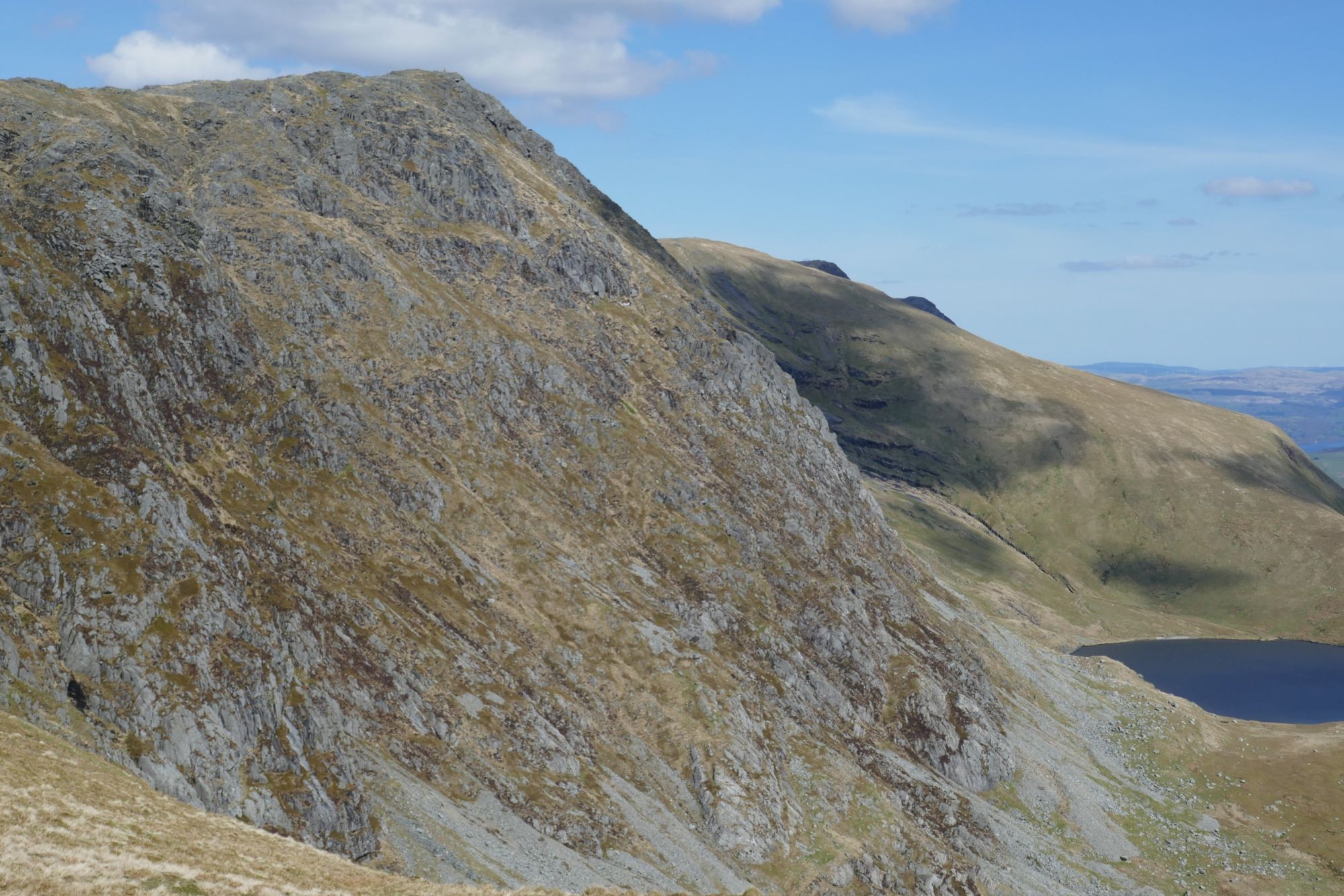
Looking back: branching off the stream gully path, with Glasgwm behind. The white bags were full of shale scalpings airlifted in to improve the path across this next section.
The fence-line is going to be your unsightly but steadfast friend for this next part of the ascent. The path follows it, and takes you through alternate drier and boggier ground with the remains of the original boardwalk still of some benefit here and there. There has been considerable improvement made to the path with the worst stretches now filled in with shale scalpings, and here and there, a new boardwalk section. You will also be ascending, but much more gradually now, with wonderful distant views north towards the Rhinogs (nearer) and the far Yr Wyddfa/Snowdon range most obvious. Cadair Idris also comes into view behind the curving lump of Glasgwm. Looking deceptively close up ahead is the graceful triangle of the main part of Aran Fawddwy,
.JPG)


After just over a kilometre of this kind of terrain, follow the fence-line as it veers slightly to the left, and the way steepens, still with pockets of wet ground in between rocky outcrops. After about ½ km of this, the fence veers back slightly to the right again, and there is a definite change with the ground getting drier, rockier, and steeper.

Then at a fence corner and ladder stile (see above), the obvious way is to leave the fence (which veers off left) and strike out more to the right towards the first of the two summits, over shattered rocks and weather-beaten short grass. There is no one obvious path now, but several possible, so a compass bearing will be needed in low cloud, bearing in mind that there is a major precipice over to the right of the summit mass.


You can avoid going over this first top, but keep to the left of it and make for the trig pillar on the main summit which is quite prominent. From the summit on a clear day, the next main summit of the Arans (Aran Benllyn at 884m) is seen to the north along the ridge, with Llyn Tegid and Bala far beyond. Very close to you on the east side of the summit is a mighty precipice dropping down to the small glacial lake which is the source of the Afon Dyfi


When you are ready to descend from the summit, choose a direction towards the subsidiary summit (marked 870m on the OS map) that you passed before, but this time, go over it or slightly to its left (be careful of the drop further to your left). There is a path which winds down from this summit in the correct direction at first roughly south to a small cairn, then dropping down to join a wire fence to the left. This runs south east along the top edge of a wide flatter grassy area, heading upwards again somewhat towards Drws Bach and the narrower east ridge.


Without much real ascent, you easily arrive at Drws Bach, with its memorial and plaque, and wonderful views of Gwaun y Llwyni and towards Cwm Cywarch. Immediately after the memorial, following the path gets you to the brief narrowest part of the ridge, but even here the unsightly wire fence and its easy grassy walking means that there will be no vertigo worries for anyone.


The path then follows the top of the rapidly broadening grassy ridge towards Drysgol, which is probably not worth a visit, so choose the path option (slightly right) that skirts around the side of this grassy mound, a little way off its summit, and for a short distance you get quite exciting very steep views into the valley far below.


Eventually, the path curves round to the right and drops fairly rapidly towards a broad boggy bwlch, labelled ‘571 m’ on the OS map. Here there are a couple of timber ‘bridges’ across the wettest parts of the path. Ahead is the low summit called (appropriately) Waun Goch, but don’t follow the quad bike tracks up it…instead branch right to find the beginning of your descent path along the side of the valley called ‘Hengwm’).


There then follows a glorious easy, downhill amble of about 2 km in a straight line heading towards your starting point, along the side of Hengwm. The views are quite amazing, and any afternoon sun shines straight at you. There are no complications until you are very near the bottom, where you should follow the first yellow waymark arrow you see, straight down to the bridge and ford on the valley lane, where you turn right for a very short distance to the car park.


Paul Campbell:
Jul 04, 2024 at 11:57 AM
Absolutely stunning photography there Rachel, What a nice looking walk too
Charlotte Pountney:
Jul 28, 2025 at 07:55 AM
This really is an excellent description, Rachel. Thank you very much. I wrote out your instructions and they were invaluable. So good, in fact, that I omitted also looking at the map after the footbridge on the ascent up the stream gully. It really is very eaay to go wrong here...and I did. After some yomping across bog towards a fence on the skyline, with difficulty, we crossed a stream not mentioned in your description (Camddwr) and the penny dropped. A look at the map and compass got us back to the correct fence. It's a superb walk and your description made it much easier for us to wayfind, I'm only mentioning my mistake as a warning to others not to underestimate its difficulty - and check where you are on your map! We didn't see anyone all day, on an exceptionally dry August Sunday.
Maurice Kyle:
Aug 14, 2025 at 08:24 PM
Many thanks for your comments Charlotte. I am glad you had a great day on this favourite of ours!
Charlotte Pountney:
Jul 28, 2025 at 07:55 AM
This really is an excellent description, Rachel. Thank you very much. I wrote out your instructions and they were invaluable. So good, in fact, that I omitted also looking at the map after the footbridge on the ascent up the stream gully. It really is very eaay to go wrong here...and I did. After some yomping across bog towards a fence on the skyline, with difficulty, we crossed a stream not mentioned in your description (Camddwr) and the penny dropped. A look at the map and compass got us back to the correct fence. It's a superb walk and your description made it much easier for us to wayfind, I'm only mentioning my mistake as a warning to others not to underestimate its difficulty - and check where you are on your map! We didn't see anyone all day, on an exceptionally dry August Sunday.
Maurice Kyle:
Aug 14, 2025 at 08:23 PM
Many thanks for your comments, Charlotte...I'm glad you had a great day out!