


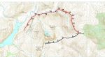
As promised in the short, straightforward walk description for Pumlumon Fawr from Maesnant, I have researched a much longer descent taking in Pumlumon Arwystli and down into Cwm Hengwm by way of Cwm Gwerin (this route description assumes that you have already reached the summit of Pumlumon Fawr). This is a serious undertaking with difficult going underfoot, and no clear paths, and from the summit of Pumlumon Arwystli you should allow at least 2-3 hours for the return to the Maesnant starting point.
A very much easier and scenic alternative to this one is to turn left at Point 5 below, head roughly north west alongside a fence in the direction of Pen Cerrig Tewion, and drop down to Llyn Llygad Rheidol alongside Nant y Graig-las, where there is something of a path developing. From the lake, there is an easy to follow path, boggy in places, alongside Nant y Llyn down to Point 21. NB: Crossing Nant y Llyn at the bottom end can be tricky after a period of prolonged heavy rain. This route would add 1 ½ -2 hours and about 4-5 km to the original Pumlumon walk.
However, the Cwm Gwerin descent route gets you to experience the wildest, most remote ‘hidden’ valley in the region, possibly in the whole of Wales, with an extraordinary rugged beauty second to none. It must be emphasised that there are long stretches where there is no clear route, and the directions and photos here are just by way of general guidance…you must find your own best way among the faint sheep tracks, tussocks, and rocky screes. Although it makes a lot of sense to explore Cwm Gwerin from Cwm Hengwm as a ‘there and back again’ adventure, it is NOT recommended to ascend Pumlumon Arwystli from Cwm Gwerin…it is a long, unremitting, and hard-going slog. My thanks to Robert Newell who helped reconnoitre this amazing place, and appears in some of the photos. Also to Jon Orchard, seen in the first few pics, who also experienced the cwm on a brilliantly sunny day some time ago. (Pictured below is Craig yr Eglwys in Cwm Gwerin)

(opens in new tab):
of starting point :
The starting point is the summit of Pumlumon Fawr (see the main Pumlumon via Maesnant walk description)
From the summit, walk on the path alongside the fenceline briefly heading north east, then bending more right after a short distance and leading slightly north of east:

Descend towards the bwlch, keeping the fence on your right, soon arriving at a point level with a cairn on the other side of the fence (see below):


- Keep going on the path gradually uphill until you reach another cairn on a subsidiary summit at 727 m. Close to here you will spot a marker stone (‘1865’) which apparently marked the border of land originally owned by Strata Florida Abbey (see below):


Continue in the same direction on the path, even though the fenceline has turned sharply right, and after 300 m or so, arrive at a gate where you meet the fence once again, coming in from the right. Ahead you will see Pumlumon Arwystli.

Keep following the fence, which bears slightly to the right here, and descend very gradually to the next bwlch at about 680 m. Near here there is an eroded area where a small path forks left off the main track. Take this path, diverging somewhat from the fence, heading straight for Pumlumon Arwystli.


Follow this small grassy path winding through the boulders until you reach the first of two rocky summit shelters.


After a good long rest and refreshment on the summit, head downhill towards the dark plunging profile of Craig y March in Cwm Gwerin on a bearing of 280 degrees for 200 m or so, passing to the left of a prominent crag.


Then bear more to the right at 320 degrees, descending across the tussocks following sheep tracks, but keeping fairly high above the cwm below to the left.


Opposite, to the left across the cwm, you will see the dramatic rugged shape of Craig y March, and a landmark here is a stream gulley to cross where a rock sticks out at an angle (see RH pic below, looking back at the rock)…Choose the best sheep track to follow, descend very gradually, but keep high above the cwm. Please note that in some of these pictures, Rob Newell is seen walking in the opposite direction, as on the day of the recce, we walked both up and down the cwm, to try to establish the best routes.


Hopefully, you will eventually find yourself on the top edge of a ridge with something of a path along the top, and fine views of the cwm in both directions. You may see a lone conifer above a small scree on the side of the steep incline below (see LH pic below):.


Keep going in this direction and ahead of you will appear the prominent gulley of Nant Felen. Unfortunately, there is now a newish wire fence to cross (not barbed) before getting to the gulley that the landowner has seen fit to march across this wonderful Access Land.


Cross Nant Felen where convenient(see LH pic below) and try to pick up a faint track here which descends only a little, keeping fairly high and heading towards the patches of screes on the hillside. The right hand picture below is looking back the way we have come (There seems to be an alternative option here of taking a much higher route which leads over the top of Craig yr Eglwys ahead. This may well be okay, but I haven’t tried it yet.)


The main thing here is to keep above the level of the marshy, tussocky ground that spreads up from the stream below…however inviting some of it looks with the odd quad bike track here and there, it is not advisable to descend too far towards the stream, except much further down the cwm. Pick your way across rocky patches, and further on there are natural outcrops whose bedding planes rise vertically, making them look like ruined buildings…pass these and cross rocky screes on sheep paths.


You may notice a point where the large tussocks of Molinia grass seem to have spread right up high to your level, and amongst this, there seems to be an easier green grassy slope down to the stream (see third picture below). It is possible to descend to the stream here and pick your way along its bank until you find quad bike tracks to make the deceptively tough going a bit easier, but again, I would advise you to stay higher for a much more pleasant time, under the impressive glowering crags of Craig yr Eglwys.


Down in the valley, you should see intricate meanders in the stream below to the left, and now you might be on an easier to follow path or quad bike track. Above you to the right is Craig yr Eglwys, and you must continue to pick your way across boulder fields.


Now you will be able to look ‘round the corner’ to the west down the broad U-shaped valley of Cwm Hengwm, and be able to spot what really is a ruined building by a small group of trees where the stream meets the Afon Hengwm. Soon the track bends round to the left and heads for the the confluence of the two waters near the ruin, passing a wonderful little crag with a tree on your right. Over to your left is a nice waterfall in the stream, and finally you should arrive at the point where the stream meets the river and it is usually easy to jump across. After weeks of rain, it might be necessary to wade, or slog back upstream to find somewhere easier.


Once across the stream it would be nice (but wrong) to think that all your hard-going trials and tribulations are over. For a time, it actually is easy walking alongside the ruin, passing through the two openable gates of disused sheep pens, and heading west towards the sunset on a good track along Cwm Hengwm. Don’t forget to look back at the curvy folded layers of rocks that make up Craig yr Eglwys (see large picture 5 below):


Soon, however, the track bends right, goes through another gate, and headsoff towards difficult ground that you can do without: a ford across the river, and a redundant meander in the river bed. I think it is much better to turn left here alongside the fence even though it is a bit tussocky. Eventually, the fence (and faint path) bear round to the right, getting closer to the river.


The faint quad bike track then crosses tussocky Molinia grassland, although not too difficult to walk, and bears right again to bypass a small rocky outcrop that you can just about see in the pictures below. Ahead you are now getting closer to the copse of conifers that is your landmark for the beginning of the easy track back to the starting point of the walk. Keep on the faint track through the worsening tussocks and by the meandering river…even on the track, it is hard work and frustrating at this stage of the walk.


At last alongside the copse, a proper path appears, and very soon you are on the easy well-marked track.
You have to jump across a small stream, and then begin the final 1 ½ km along the rubbly track with the prominent hump of Drosgol ahead.
Soon, the water of Nant y moch Reservoir appear as the track bends round downhill.


There is then a stretch of gradual uphill walking along the track to finally arrive at the starting point at Maesnant.

Tiago Oliveira:
Jun 03, 2025 at 02:21 PM
Hi, I'm planning a trip to Pumlumon in August and this route seems great! How boggy is it, and is the return leg through Cwm Gwerin manageable (just a bit slow)? Thank you!
Maurice Kyle:
Jul 06, 2025 at 03:27 PM
Thanks for your question...As always, it depends on your ability and experience. The areas close to the stream in the valley floor are very difficult, mainly because of deep water-filled holes between the tussocks. It is best to keep above the tussocky (Molinia) grass as far as you can, and I advise the right hand side of the valley looking down it. Although we descended below Craig yr Eglwys (at the bottom end of the valley), there seems to be something of a path keeping higher...over the top of the crags. I have walked through Cwm Gwerin four times now, I have still not found as ideal route, but take care and persevere, and it's quite OK. Make sure you wear waterproof boots!
Tiago Oliveira:
Jun 03, 2025 at 02:21 PM
Hi, I'm planning a trip to Pumlumon in August and this route seems great! How boggy is it, and is the return leg through Cwm Gwerin manageable (just a bit slow)? Thank you!
Tiago Oliveira:
Jun 03, 2025 at 02:22 PM
Hi, I'm planning a trip to Pumlumon in August and this route seems great! How boggy is it, and is the return leg through Cwm Gwerin manageable (just a bit slow)? Thank you!
Steve Woodward:
Jan 12, 2026 at 04:02 PM
I walked Cwm Gwerin as part of an overnighter in the autumn. Despite a really dry summer (2025) it was really really hard work. It made walking in the northern part of the Rhinogydd seem easy. The point about there being no path, especially on the valley floor, is well made. The terrain consists of tussock after tussock, after tussock - you get the idea - interspersed with bog. A couple of times I was wallowing up to my waist almost as though I'd postholed in snow. It's a work out and progress is really slow. Upside - there is nobody around the feeling of quiet and being alone with nature is fantastic. I got to see ospreys hunting (presumably from the nest site on the Dyfi) which for me was one of my nature highlights of the year. I am struggling to think of anywhere that feels as remote as this valley anywhere else in Wales.